Search
Close this search box.

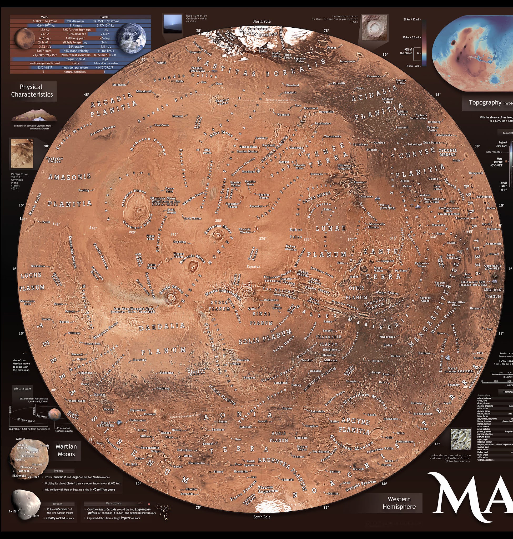
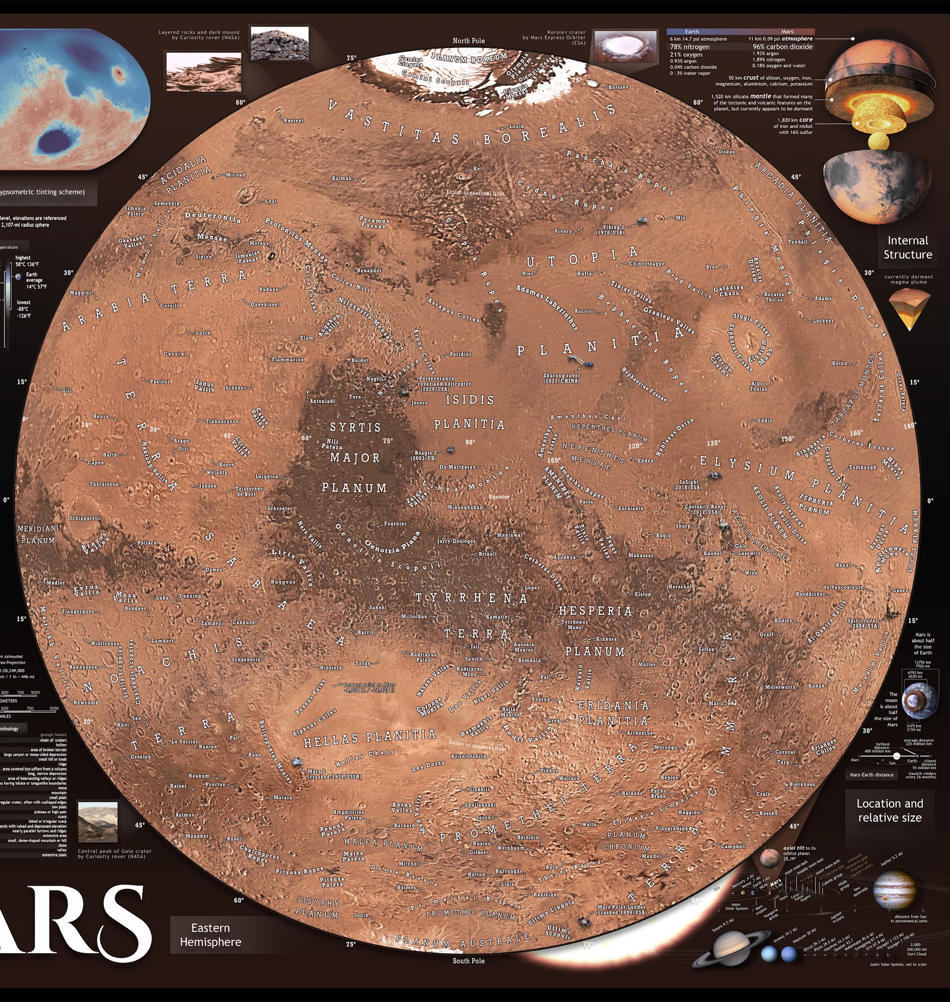
Very detailed Map of Mars

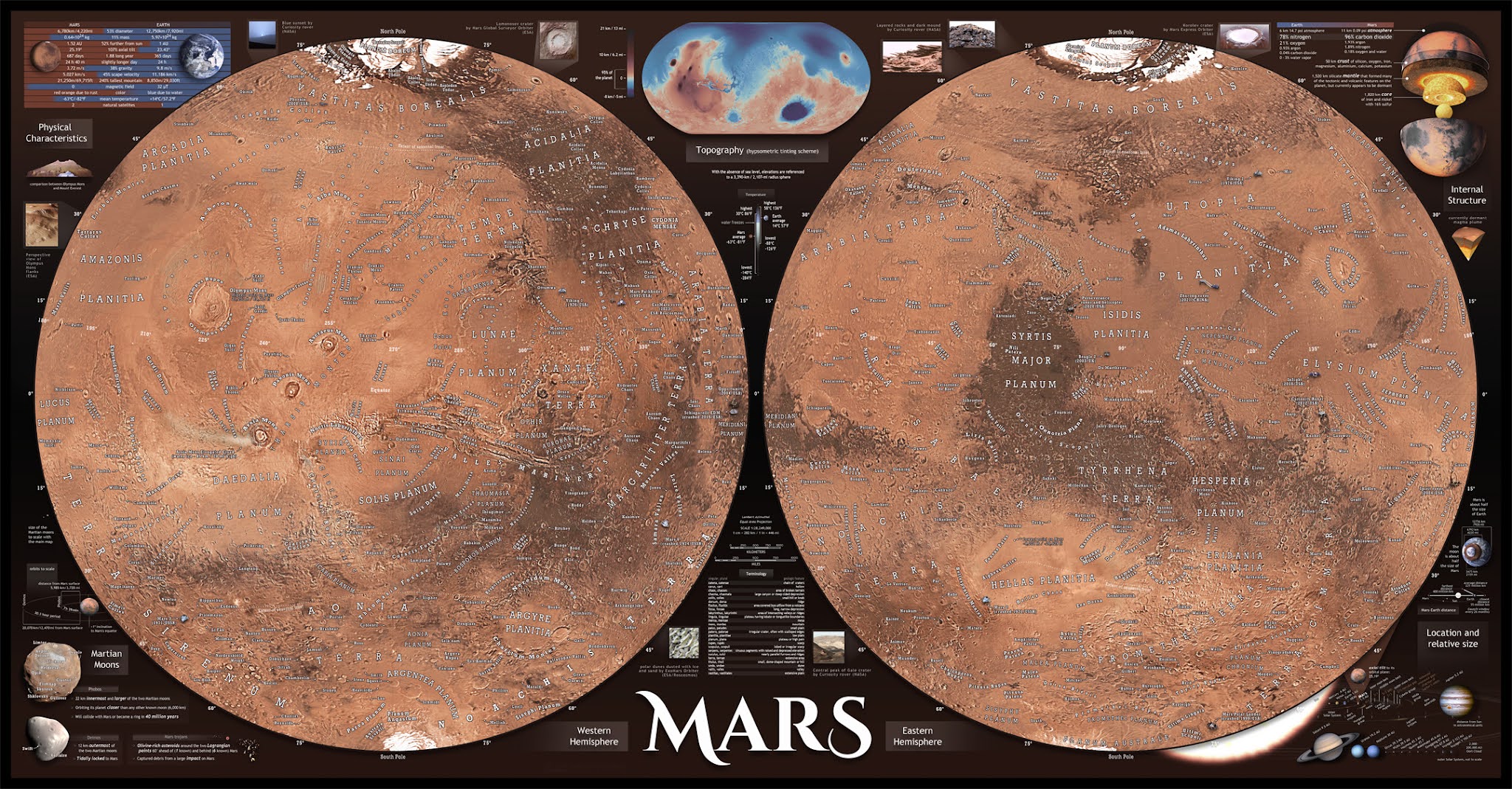
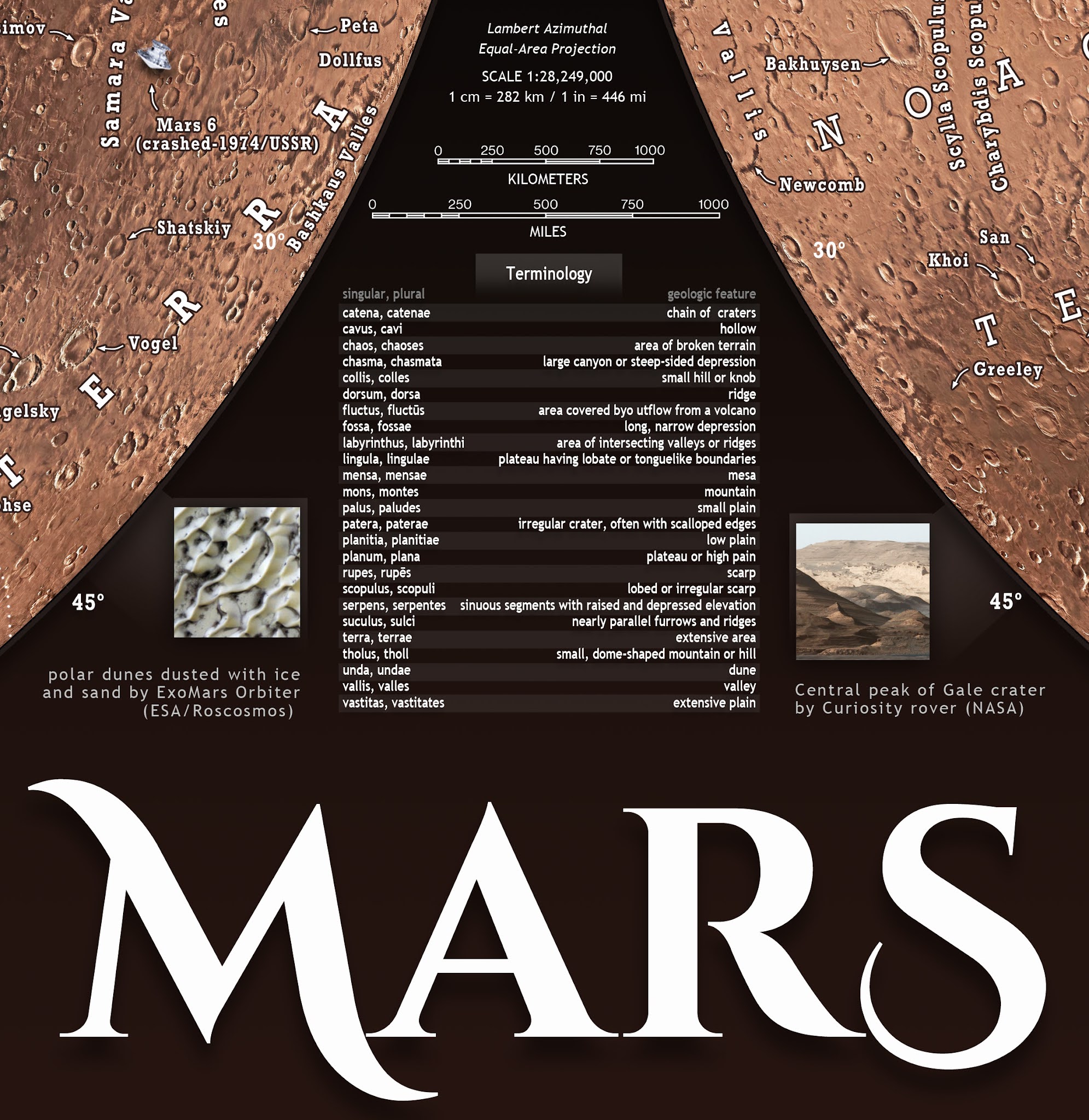
This map of Mars, displayed in Lambert Azimuthal Equal-Area Projection, features annotations of geologic structures including 250 craters.

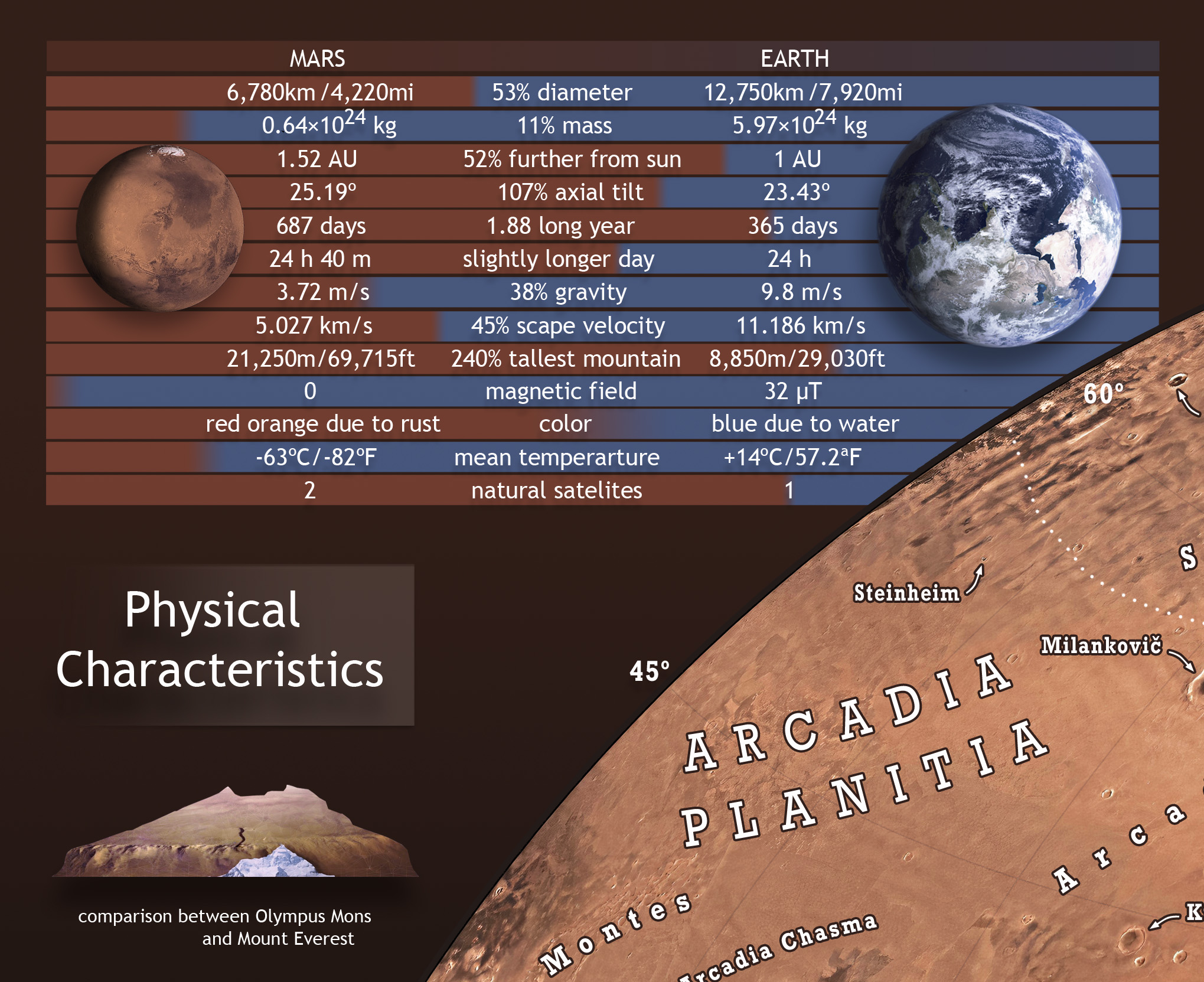
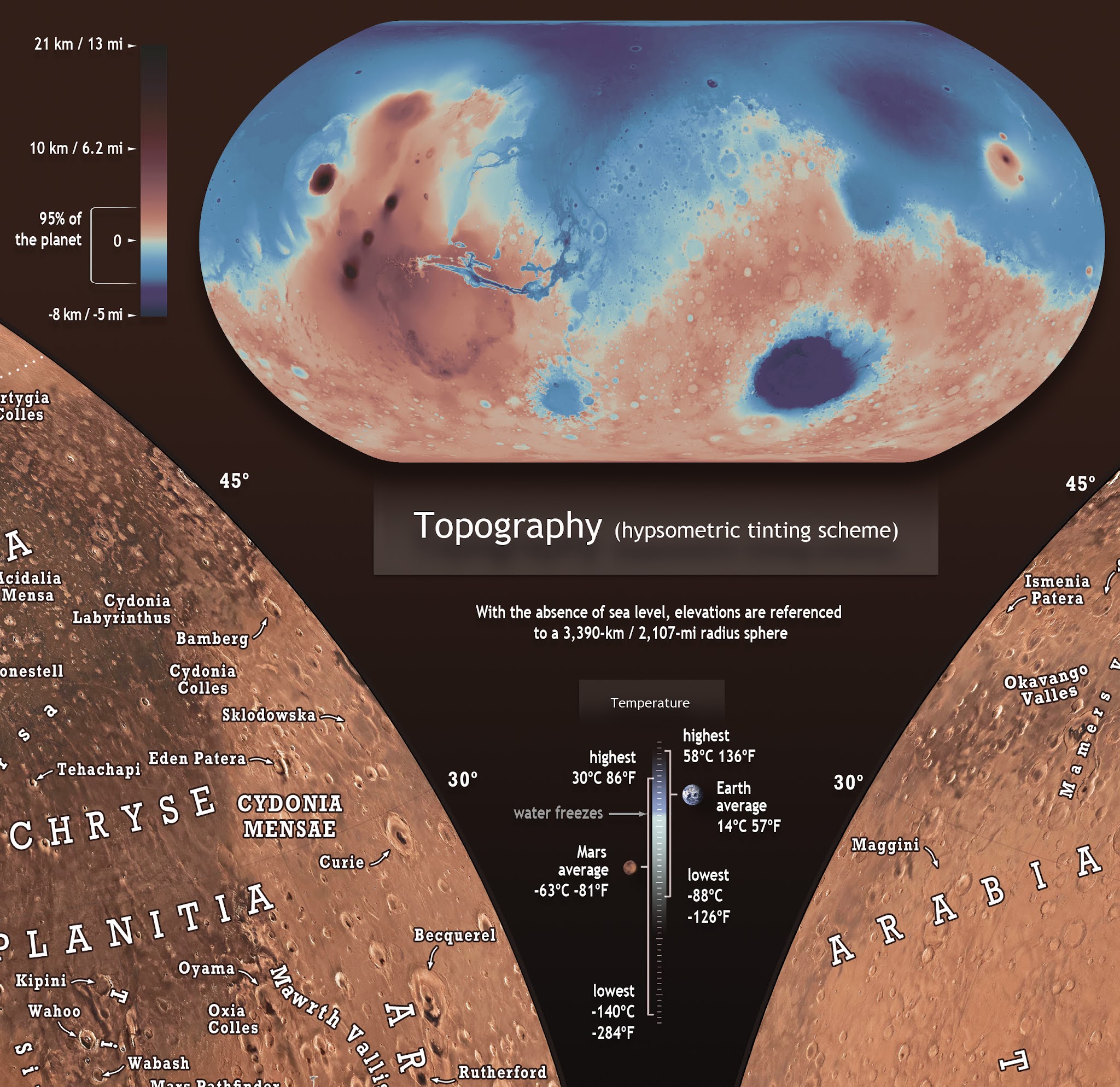
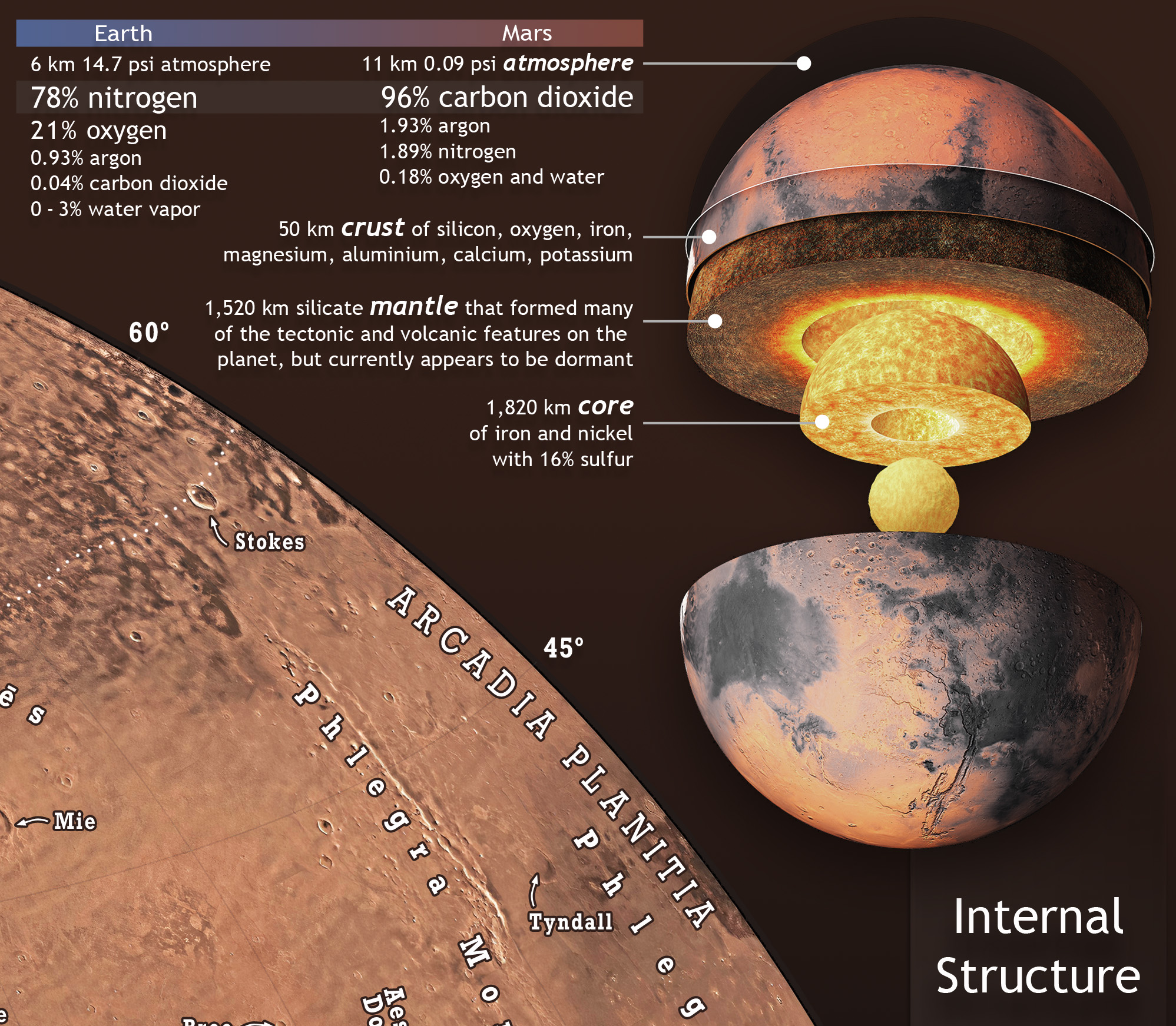
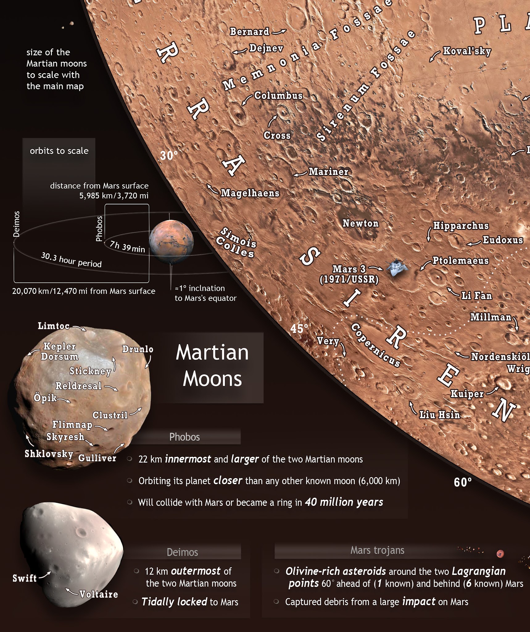
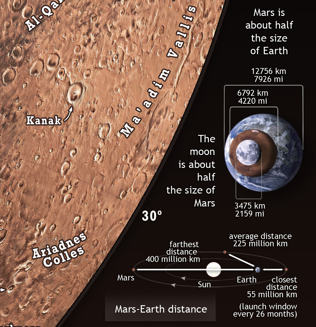
Infographics around the map provide information on Mars’ physical characteristics compared to Earth, details about its moons, elevation tinting scheme, internal structure, geologic terminology, its location in the Solar System, and size comparisons with Earth and the Moon. 

Developed by Pablo Budassi in 2024, this map contains detailed annotations, including 16 human exploration mission landing sites and future mission sites.

In the coming years of the new space age, as we become a multiplanetary species, the “Red Pearl” will be more present than ever in our lives and we should become familiar with it. This detailed map of fine design in a study or living room would be a good starting point!


explore and zoom below –  maximizing screen is recommended for a better viewing experience


Data acknowledgments:

The map is based on the colorized mosaic by NASA AMES, which integrates the Viking colorized mosaic with the latest Mars Digital Image Model (MDIM 2.1). The projection was processed using G.Projector software from NASA Goddard Institute for Space Studies, which utilizes several open-source Java libraries.

The names of features were sourced from the International Astronomical Union (IAU) Working Group for Planetary System Nomenclature (WGPSN). 


Get your Map of Mars at the links below:
 
Related Work: 
Hope Mars Mission Best Picture *2022*


Beautiful photo of the red planet processed from the data from the UAE’s Hope Mars Mission. This version comes with a star background. Check transparent background here: High quality carefully processed by Pablo Carlos Budassi, in September 2022. 
Images and data used credit: CU/LASPEMM/EXIITF/KevinGill.


 Korolev crater.
 82-kilometre-across in the northern lowlands of the Red Planet, south of the large Olympia Undae dune field that partly surrounds Mars’ north polar cap, this well-preserved impact crater is filled with water ice all year round. The crater’s floor lies two kilometers below its rim, enclosing a 1.8 km thick domed deposit that represents a large reservoir of non-polar ice on Mars.
Water ice is permanently stable within Korolev crater because the deepest part of this depression acts as a natural cold trap. The air above the ice cools and is thus heavier compared to the surrounding air: since air is a poor conductor of heat, the water ice mound is effectively shielded from heating and sublimation.
This oblique perspective view was generated using a digital terrain model and Mars Express data gathered in 2018. Colors and light curves were remastered by space artist Pablo Carlos Budassi.
Images and data credit: ESA/DLR/FU Berlin, CC BY-SA 3.0 IGO


bit.ly/korolevcrater


Valles Marineris and Phobos Eclipse Aereal View
The 11km atmosphere limit is visible on the horizon. Artist conception with realistic style. August 2021.


* All products and downloads are delivered in excellent quality and without watermarks.
 
* Share this page with a friend using the following link:
* Become a Patron of this project for $2/mo and get full access to all our high-resolution works.
* Check out other graphics from our team at our ROOTPAGE 
Share.